Coldest Day: July 22, 1965 -80.6°C (-113°F)
Warmest Day: January 12, 1958 -15.0°C (5°F)
Mean Temps:
Winter: -40 to
-94°F (-40 to 70°C)
Summer: -5 to -31°F (-15 to 35°C)
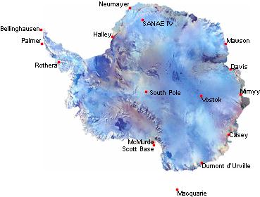
Neumayer - McMurde 3.500 km / 1.890 nm 12hrs
Coldest Day: July 22, 1965 -80.6°C (-113°F) Warmest Day: January 12, 1958 -15.0°C (5°F)
Neumayer - McMurde 3.500 km / 1.890 nm 12hrs |
|
|
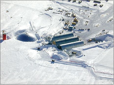
South Pole Station Nationality: United States
|
|
Information: The station is at an elevation of 9,300' (2900m), however the equivalent pressure elevation, based on polar atmospheric conditions, will vary from 10,800(3300m) to 13,120 (4,000m). The new station is about 350 meters from the true Geographic South Pole.
Web Cam:
http://bat.phys.unsw.edu.au/~aasto/
Website:
www.spole.gov
Wildlife:
None, other that an occasional lost & desperate skua.
Images:
Today at South
Pole and other recent images.
|
|
| mountain chain stretching across Antarctica from Victoria Land to Coats Land; separating the E Antarctic and W Antarctic subcontinents. Mt. Markham (14,275 ft/4,351 m high), near the Ross Ice Shelf, is the highest peak. |