Northern Hemisphere
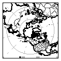
ANALYSES (every 6 hrs)
|
Eastern Pacific &
Western North
America
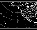
ANALYSES (every 6 hrs)
Analysis overlying an
IR Satellite Image
FORECASTS
(usually valid from the time
of latest-available analysis)
|
North America
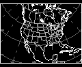
ANALYSES (every 6 hrs)
Analysis overlying an
IR Satellite Image
FORECASTS
(usually valid from the time
of latest-available analysis)
|
North Atlantic
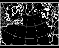
ANALYSES (every 6 hrs)
Analysis overlying an
IR Satellite Image
FORECASTS
(usually valid from the time
of latest-available analysis)
|
The 850 mb chart
The 850 mb chart, representing weather conditions in the lower
troposphere, is at a level that is above approximately 15 percent of the
atmosphere in terms of mass. At an altitude of approximately 1500 meters (5000
feet), this level is above most of the influences of surface friction in the
many sections of the country. Unfortunately, the 850 mb intersects and goes
below the terrain in the Rocky Mountains. For example, the "Mile High City" of
Denver, CO usually has a surface pressure - a measured value not corrected to
sea level - of approximately 830 mb, which places it at a higher altitude than
the 850 mb surface. Meteorologists often look at the analyzed temperature field
of this level, because over the non-mountainous regions, the diurnal temperature
cycle is much less than at the surface. They can frequently tell correctly that
precipitation falling in regions with an 850 mb temperature of 0 degrees Celsius
will probably fall as snow, while rain would more than likely fall at warmer
temperatures.
The 500 mb chart
The 500 mb chart represents weather conditions in the mid-
troposphere, at a level where approximately half the mass of the atmosphere lies
below this level. This level is at an altitude of approximately 5,500 meters
(18.000 ft). This level is often used to represent upper level flow conditions
because the level is well above the effects of topography and friction and the
level is below the region in the upper troposphere where the air flow may
experience strong accelerations and decelerations when in the vicinity of the
upper jet streams. Since many weather systems tend to follow the wind flow at
this level, this level is often considered to symbolize the steering level of
these systems.
The 300 mb chart
The 300 mb chart is in the vicinity of the tropopause, at the
top of the troposphere. Only 30 percent of the mass of the atmosphere lies above
this level. The altitude of the 300 mb surface is near 9000 meters (30,000 ft) -
at a level where many long-distance commercial jet aircraft fly. This level also
corresponds the level of the upper tropospheric jet stream, a region of very
fast winds that move across the country. Inspection of the isotach patterns at
these levels not only reveal the location of the jet streams, but aid the
meteorologist in locating the regions of largest acceleration, deceleration and
wind shear (rapid changes in wind speed and/or direction); these regions
contribute to the upper level horizontal divergence and convergence patterns
that influence surface weather systems.


